

Tucked away in the mountains surrounding Sonoma Valley, CA is Sugarloaf Ridge State Park, a 90 minute ride away from the East Bay.
I was yearning to finally get out camping in April for my first trip since completing the Pacific Crest Trail. There were two reasons why I chose to do an overnight trip in Sugarloaf:
- I’m fairly certain it was the last non-ADA campsite available in the state of California when I was trying to book for the weekend.
- It provided a unique opportunity to see the regrowth of the North Bay following the expansive wildfires that occured back in fall.
I had originally planned to go on a secluded solo overnight backpacking trip, but when nature was apparently already booked, I decided to snag the last campsite in the state of California (probably) and do my first bout of car-camping since high school.
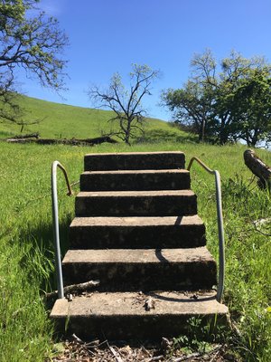
Sugarloaf boasts over 25 miles of hiking trails in the mountains between the Sonoma and Napa Valleys. They have a visitor’s center, campgrounds (with fire pits and picnic tables) with bathrooms, potable water, and showers, and even an observatory. Compared to my PCT adventure, this was an amenity-packed trip.

Day 1
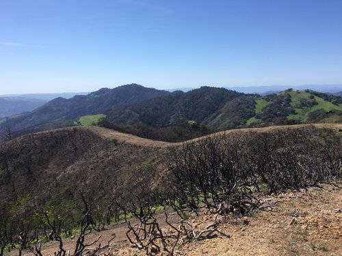
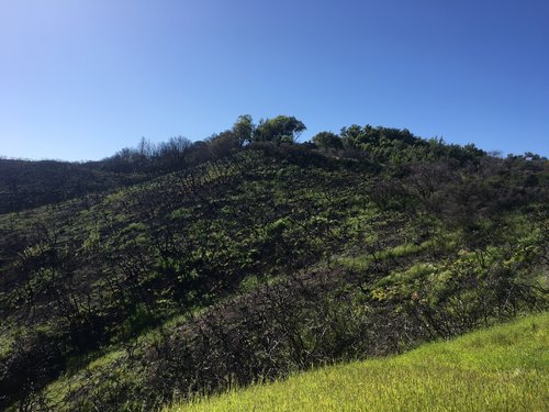
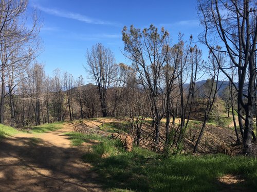
I arrived at Sugarloaf on a Saturday at around 12:20 p.m. As you might be aware, this area was hit hard with wildfires back in fall. Driving up to the park gates, you could see the large swathes of land that had been charred by the fires, which was a stark contrast to the vibrant green grass that saturated the landscape.
The park was bustling at that point in the day, but friendly park volunteers were eager to check me in and show me popular trails on the map. It was clear they were excited to have so many folks come enjoy the park as they had recently reopened after restoration efforts following the fires. I was amused when one of the volunteers offered to sell me firewood without a tinge of irony in her voice.
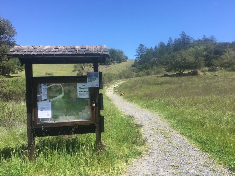
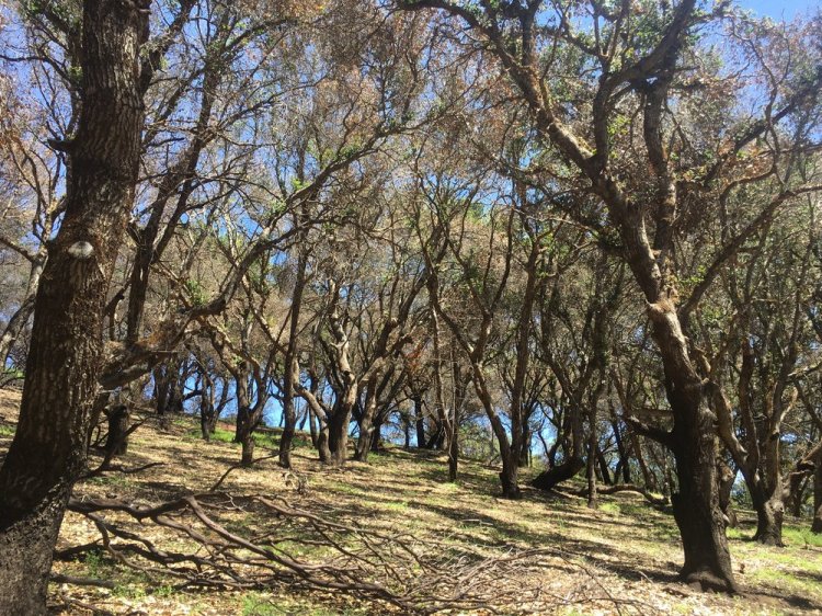
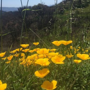
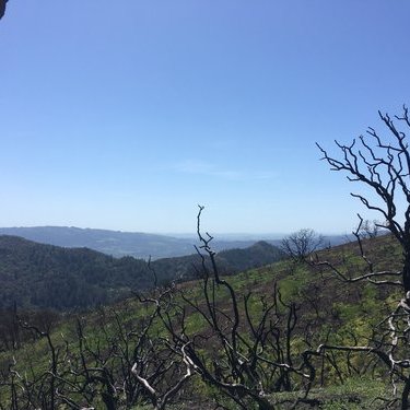
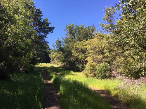
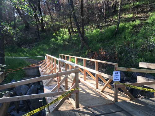
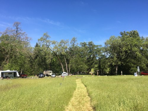
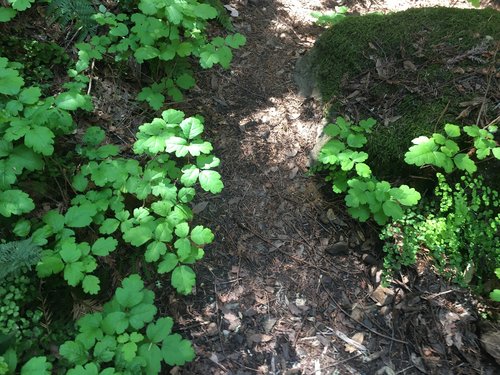
After I parked my car in Campsite 29, I was eager to hit the trails. I walked to the day parking lot where the Lower Bald Mountain Trail began. As I ascended, the lush, springtime greenery was quickly contrasted with the blackened trees, charred from last year’s wildfires. I couldn’t get over how fascinating it was to see the leaveless, charcoal black trees tucked away in the vibrancy of the new life. On the Pacific Crest Trail, we had oftentimes walked through burn areas, but the life and death was never as intermingled as it was in Sugar Loaf.


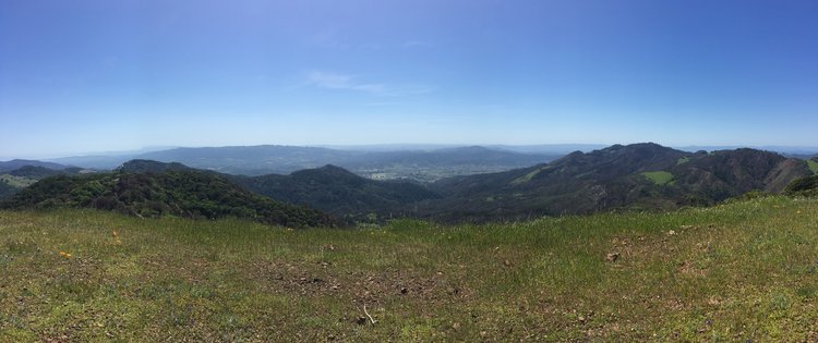
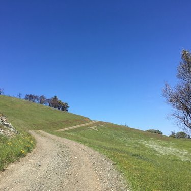
After a little over half a mile on trail, I came to the junction at Bald Mountain trail, which was technically a service road. I wouldn’t walk on a proper trail for the rest of the day. From this vista point, I looked back to where I had started. In true Napa/Sonoma fashion, I could spot grape vines on a hill to the south.

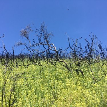
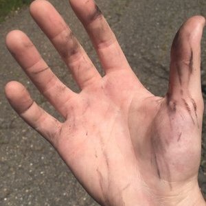
The service road went up and up, winding around the mountains. I stopped at another burned tree to touch it. My hands soon became covered in ash. A very fresh burn. I wondered what this land would look like in a year, five years, ten years.
Pretty soon, I had made it to the top of Bald Mountain. I hadn’t researched the mountain, but now I gained that the mountain may have gotten its name due to the lack of foliage at the top. I dropped my pack and sat overlooking the views while eating the sandwich I had packed for lunch.


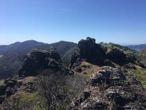
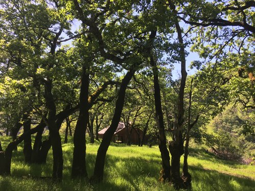
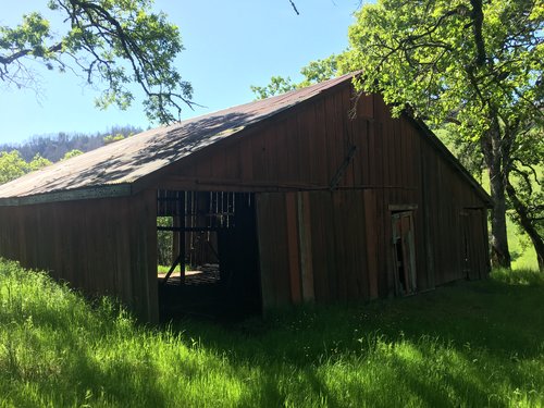
Since I had made it to the highest point in the park before 2:00 p.m., I decided to venture to what was marked as Red Barn about 1.5 miles from the top of Bald Mountain. To get to Red Barn, I walked on more service roads, but there was not another soul to be found. I had the trail all to myself, so I spent time singing out loud. If you venture down to Red Barn, I highly recommend climbing on the rocks on the right of the trail. I stood all the way on the highest point and nearly got knocked down by the wind. A fun time for sure!

Pretty soon I realized why no one was on this route. It basically went down the entire time – pretty steep at some points, too. I had forgotten my trekking poles at home, so I had to be careful to not lose my footing on the loose service road gravel.
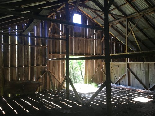
After about 45 minutes, I made it to Red Barn which was a literal red barn. It looked like it had been abandoned long ago. The light going through the gaps between the old, wood walls was mesmerizing. I spent some time here taking a break in the shade and enjoying the peacefulness of this spot.
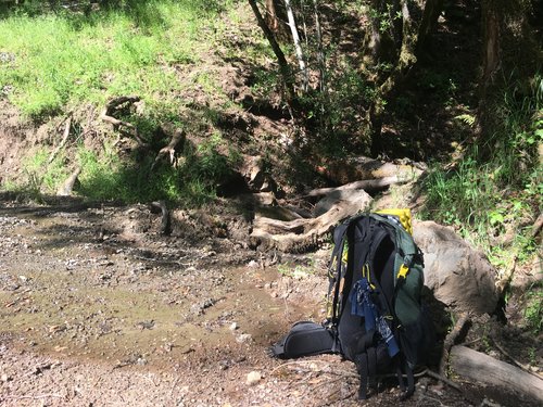
At this point, I was starting to run out of water, but luckily for me, humans tend to build structures near water sources. I took note of this and listened for a water source. I found a stream flowing nicely about a hundred feet down, where I took some time to filter water (#alwaysbringyourwaterfilter). All hydrated up, I set back to walk up the steep service road to the junction from where I had started on Bald Mountain.
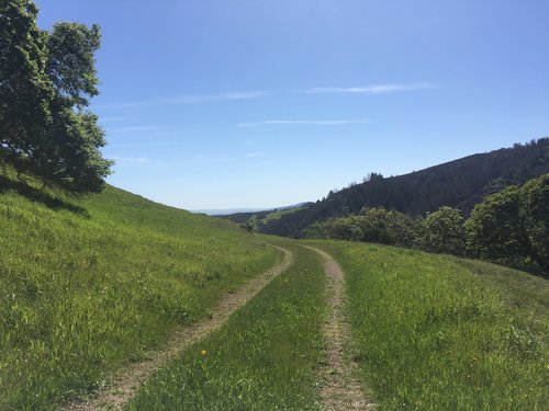
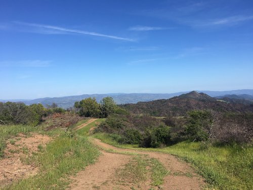
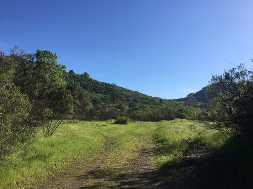
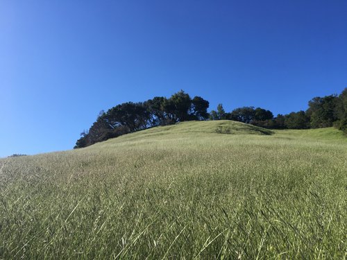
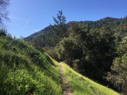
Back on top of Bald Mountain, I took Gray Pine Trail with the intention of going all the way out to Brushy Peaks Trail. I was making such good time that day that I set a goal of hiking all the trails in the state park (I would not end up hitting this goal). Gray Pine Trail was another service road that winded through the greenery along a ridge. There were some spectacular views of the park and its surrounding area.
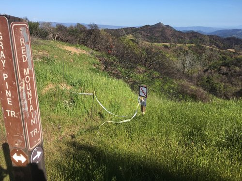
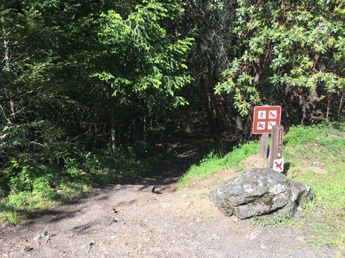
Pretty soon, I came to understand that my goal of hiking on all the trails would be infeasible as the wildfires had caused the park to close off several of the trails. Brushy Peaks Trail would have to wait for another time.
The day started to cool off as I slowly made my way down Gray Pine Trail back towards camp. There were even some creek crossings, but nothing that forced me to get my shoes wet. My feet and legs were starting to show their first signs of fatigue, so I was happy to make my way back, especially as the sun started to get low in the sky.
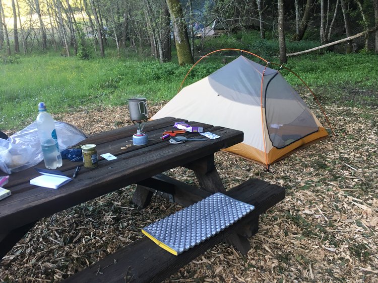
Back at camp, I set up my trusty backpacking tent (for more information on my gear, click here) and started cooking my favorite trail dinner: Annie’s Mac & Cheese. I made it even more delicious by adding pesto sauce. Yum.
As I was quietly eating my dinner and reading a book, a guttural scream erupted from another nearby campsite.
“FREEDOM!”
I looked over to see a dozen or so 12-year-old boys piling out of a van. They were teeming with energy from their ride to the campsite. Screaming, playing, cajoling each other. It was LOUD.
At first, I briefly became annoyed that these kids were going to disrupt the peacefulness of my evening. But soon I found myself instead grateful that I was not chaperoning their trip. I had done several overnight camping trips as a summer camp counselor, so I knew first hand how much work it took to set up those giant tents, cook dinner for ravenous kids, and eventually quiet them down. I was grateful to just spend time with myself reading.
Tired from my work week and the day’s adventures, I read for a few hours and found myself falling asleep at 8:40 p.m.
Day 2

I woke up naturally to the morning light in my tent at around 7:20 a.m. The campgrounds were quiet. Not needing to go anywhere fast, I lazily read in my sleeping bag until the sun cooked my tent, and I felt the urge to get out. It had been a while since I had hiked double digit miles, so my body felt a bit sore. Because of that, I resolved to do a short hike down to the waterfalls and head out before noon.
After packing up my tent, I ate a simple breakfast of apples and almond butter while watching the camp boys emerge from their tents and start a pick up game of baseball. I even broke out my old cold soak jar from the PCT (my Talenti gelato jar) and made my favorite Trader Joe’s instant coffee.
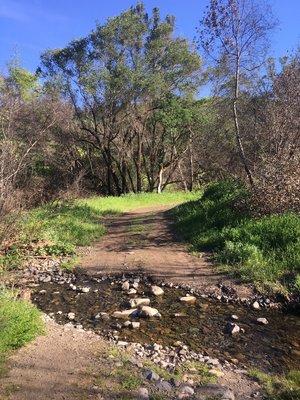
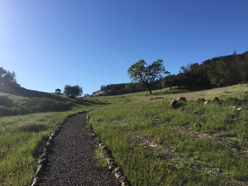
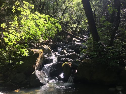
To get to the waterfalls, you walk back to the entrance kiosk by the visitor’s center to start on the Pony Gate Trail. It travels up through a grassy valley and then weaves back down into the tree cover. Pretty soon, you cross the main road to get to the waterfall trail.


The waterfall trail descends on the south side of the main road, running parallel to the creek. There wasn’t a clear sign telling you which offshoot trail to take, so after 15 minutes or so of descending, I decided to turn left towards the creek.
I quickly found myself at the base of the waterfall. It was still pretty early, so no one else was there. I played on some of the rocks and sat listening to its roar. When I felt satiated, I walked back up to the main waterfall trail and backtracked my way to the visitor’s center.

Packed up and ready to go, I said goodbye to the park and thanked the park volunteers (always thank the park volunteers) for my stay.
Sugarloaf State Ridge Park is a lovely little state park in North Bay. It was such a unique experience to walk among the burn area during such a high bloom time in mid-April. The green hills will soon turn to golden hills in the summer, but either way, I highly recommend taking a brief reprieve from the city to spend a day or night out in this area.

Thanks for the great overview of the park and especially the kind words for our amazing volunteers!JohnSugarloaf Ridge Park Manager
LikeLike
Glad to hear you enjoyed the write-up, John. Wonderful park you manage. Thank you!
LikeLike
Thiis is a great post
LikeLiked by 1 person
Thanks, Davis! Appreciate the kind words.
LikeLike